
The Big Hairy Crack | Hike 10
The Big Hairy Crack. I won't tell you where it is in the Wichita Mountains, but maybe I'll take you there someday. Maybe not.

The Big Hairy Crack
Hike 10 | 02-18-2018
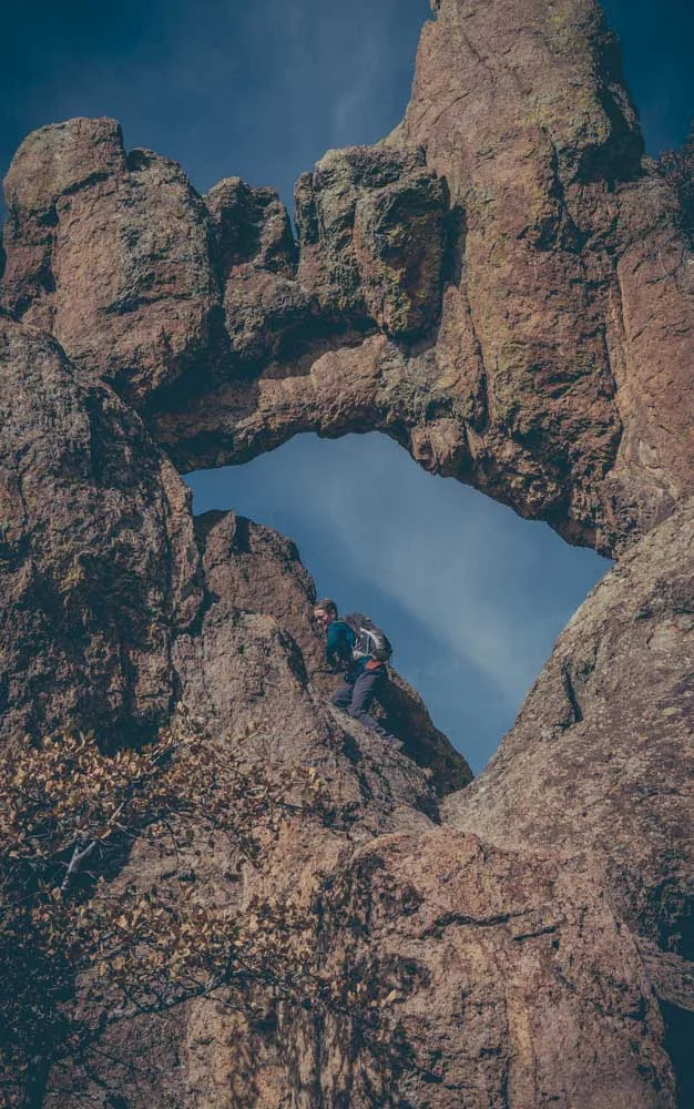
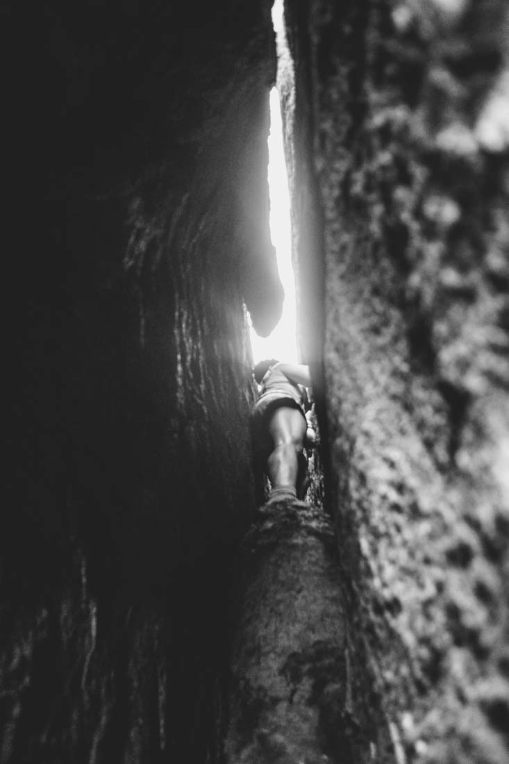
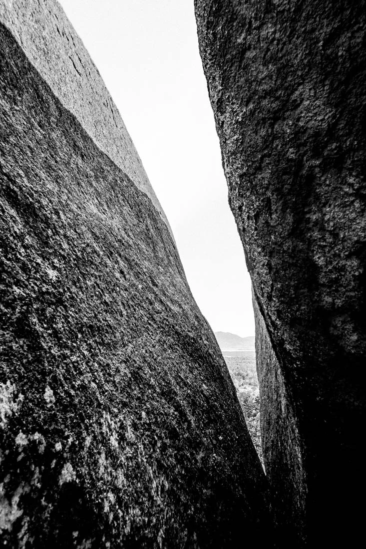
The Big Hairy Crack. I won't tell you where it is in the Wichita Mountains, but maybe I'll take you there someday. Maybe not. Before you even get to the Crack you can crawl through a number of other small spaces. Many on your belly. If you are small enough to fit. I'm not. The last time I did it, there were multiple folks in tears and the fetal position. It's not as hard as it is intimidating. You crawl down and walk through this archway that leads you to the crack. After a short break, you Spiderman diagonally down a 50 foot crack (maybe less, maybe more) that narrows below you. You can easily imagine losing your grip and getting wedged in the rocks. We're not a bunch rock climbers here. Some of us have climbing experience, but we're really just of bunch of people who find solace and fellowship hiking together. We laugh. We get beat up. We challenge ourselves. We encourage each other. We inspire. We literally lend a knee and a shoulder.


photo by Shawn Bethel


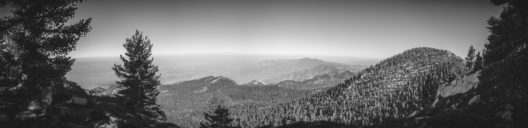
Five Dogs, One Spanish Canyon | Hike 08
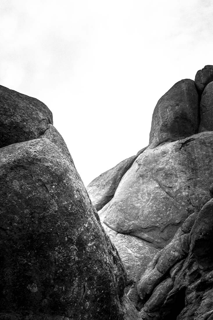
On this particular day, five dogs pulled nine humans through Spanish Canyon just as we pulled them.

Five Dogs, One Spanish Canyon
Hike 08 | 02-03-18
Some hike for the physical exercise. Some hike for the spiritual. Some hike for the fellowship. I hike in the Wichita Mountains for all of the above. On this particular day, five dogs pulled nine humans through Spanish Canyon just as we pulled them. We were all a tight pack that day and we licked each other's wounds. I think we all ended the day a little better than we were before.


Tent Rocks | Hike 04
Before driving back from Santa Fe, Angie and I wanted to hike the beautiful slot canyons of Kasha-Katuwe Tent Rocks National Monument. It was an easy but fun hike. I’m pretty proud of the pictures. I can’t wait to check out the slot canyons of Utah and Arizona. We’re most likely going to make a little trip to Utah this Spring. It was the perfect way to end our trip.

Tent Rocks
Hike 04 | 01-07-18
Before driving back from Santa Fe, Angie and I wanted to hike the beautiful slot canyons of Kasha-Katuwe Tent Rocks National Monument. It was an easy but fun hike. I’m pretty proud of the pictures. I can’t wait to check out the slot canyons of Utah and Arizona. We’re most likely going to make a little trip to Utah this Spring. It was the perfect way to end our trip.


The Natural Arch | Hike 03
While we were in Santa Fe, Angie and I took a little trip over to Los Alamos to the Old Mitchell Trail to see the Natural Arch there.

The Natural Arch
Hike 03 | 01-06-18
While we were in Santa Fe, Angie and I took a little trip over to Los Alamos to the Old Mitchell Trail to see the Natural Arch there. Google got us lost and I had lost my patience by the time we pulled up to the trailhead nestled right on the edge of a neighborhood. That was my first sign that this would be an easy, boring hike, which is exactly what it turned out to be. They had mullien everywhere. Mullien is an invasive species that we kill in the Wichita Mountains. It can eventually take over an area and make it impossible for the indigenous plants to grow. I was distracted by how much there was in the area. I kept wanting to stop and pull it as I hiked. Apparently there was a fire at some point and so it was wasteland. Overall, it wasn’t worth the effort. The arch itself is neat, but the excitement wore off fast. I do like the photos I got. Check them out.


Jan One | Hike 01
The Jan One hike has become a tradition for me. This was my third year in a row. My friends Britney and Jessica joined me on a cold morning. I think it was 7ºF when we woke up that day.

Jan One hike
Hike 01 | 01-01-18
The Jan One hike has become a tradition for me. This was my third year in a row. My friends Britney and Jessica joined me on a cold morning. I think it was 7ºF when we woke up that day. We hiked in Spanish Canyon because it always gets a bit warmer there. We laughed and found new places. I broke my GoPro first time out. Inspired by Jessica’s hikes in 2015, I decided I would do 52 hikes this year. Jessica tells me there’s a patch you can get. She says it’s based on the honor system, but she’d never wear the patch if she hadn’t really. That’s the just type of dirtbag I hike with.
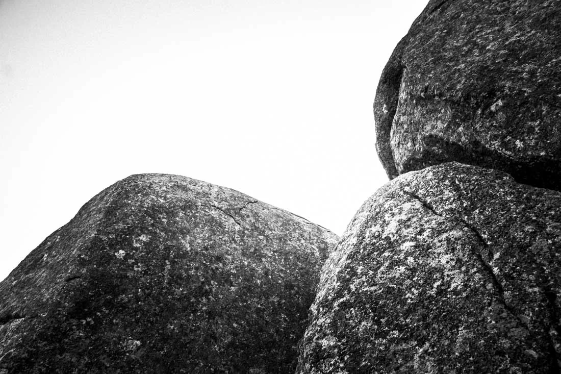


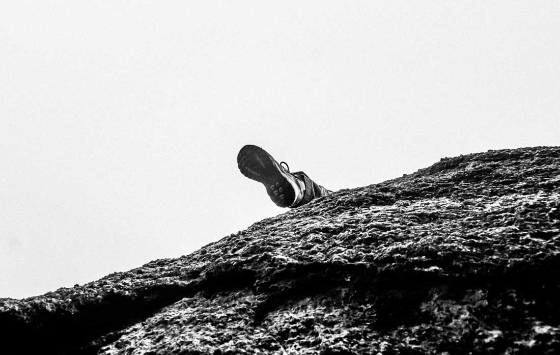


Best of 2017 in Black & White
My best black & white shots of 2017.

My best black & white shots of 2017
Click any image below to begin a slide show.


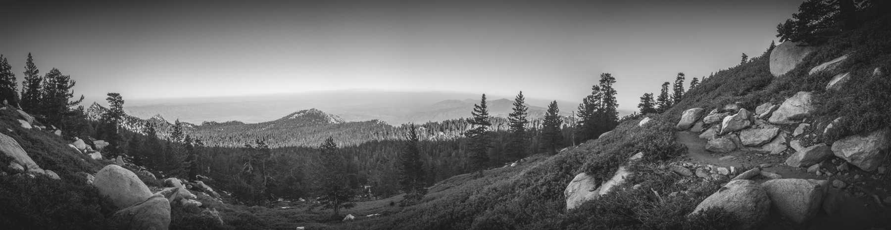
Solo Hike Around Mount Lincoln
I was feeling under the weather Saturday and didn’t want to make any of my dirtbag friends deal with my snotty nose, so I drove down for a five-hour hike on an overcast day.

Solo Hike Around Mount Lincoln
I was feeling under the weather Saturday and didn’t want to make any of my dirtbag friends deal with my snotty nose, so I drove down for a five-hour hike on an overcast day.


Crapshoot Scout Day 2
Day Two of De Cooper and I scouting Crapshoot.

Crapshoot Scout Day 2
Day Two of De Cooper and I scouting Crapshoot.
To see the shots from Day One, go to: http://www.toddeclark.com/blog/2017/11/20/crapshoot-scout-day-1


Crapshoot Scout Day 1
De Cooper and I started a long overdue scout of an area we call Crapshoot. For the last two years, De has had this idea of combining this tough hike with another tough hike we call The Chavez.

Crapshoot Scout Day 1
De Cooper and I started a long overdue scout of an area we call Crapshoot. For the last two years, De has had this idea of combining this tough hike with another tough hike we call The Chavez.
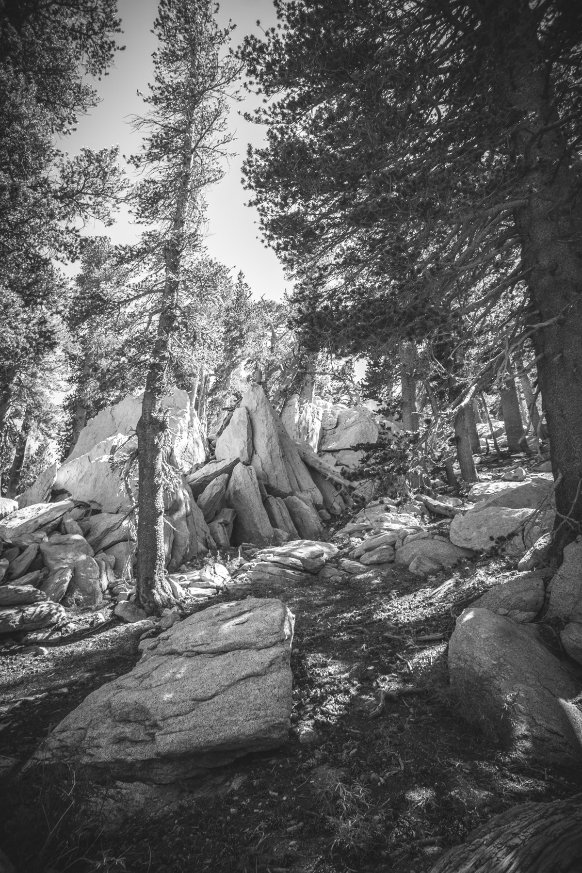
To fill you in, The Chavez is a hike named after our friend Josh Chavez, the originator of the route. It consists of parking at Post Oak and hiking up the south side of Elk Mountain to The Water Caves, then to The Rock Rooms, down The Slide and back to the car. The hike takes about 5-6 hours and can be physically draining. It’s my favorite hike in the refuge.
So De’s idea is to add Crapshoot to The Chavez making a hike that could last up to 7 hours plus through some of the most challenging parts of the Elk Mountain and the refuge.
Below are some shots of Day One. For shots of Day Two go to: http://www.toddeclark.com/blog/2017/11/20/crapshoot-scout-day-2


Women of Rock
I went on a great hike to Granite Mountain in my beloved Wichita Mountains with Angie LaPaglia, Paulina Ćwik, Britney Neubecker, and De Cooper. It’s a longer trek than some with a lot of small spaces to crawl through. At some point the term “Women of Rock” came to mind as I had this amazing adventure with three tough women.

Women of Rock
and De Cooper
I went on a great hike to Charon’s Garden Mountain in my beloved Wichita Mountains with Angie LaPaglia, Paulina Ćwik, Britney Neubecker, and De Cooper. It’s a longer trek than some with a lot of small spaces to crawl through. I was the largest so there were some spots I could not make it through but was there to document as much as I could. At some point the term “Women of Rock” came to mind as I had this amazing adventure with three tough women. They were crawling through rough places I couldn’t make it through. We were all banged up and some of us were bleeding, we faced fears, but we loved the adventure. These three strong women made me think of all the other tough women I hike with like Claire Bridges Springer, Lisa Middleton, Jessica Peterson, Shannon Trout, Amberlee Darold, Susanne Bogle, Rachel Hunter, Breeze Kelley, Sophy Hackney, Anna Paraskevopoulos, Betsy Hunter, Cat Cray, and more. I salute you all, you “Women of Rock.”


Solo Hike to the Rock Rooms
My friend, the proliferant John Reenan, asked me the weekend before if I had ever explored or ascended the northwest part of Elk Mountain. I realized I never had. I was freed up this past Sunday morning so I decided to take a solo hike there so I could tell John that I had indeed explored that area.

Solo Hike to the Rock Rooms
My friend, the proliferant John Reenan, asked me the weekend before if I had ever explored or ascended the northwest part of Elk Mountain. I realized I never had. I was freed up this past Sunday morning so I decided to take a solo hike there so I could tell John that I had indeed explored that area. Aaron Manuel was in the Visitor Center that morning hanging out with Randy Hale. Aaron said it was the fastest way to The Rock Rooms. Randy showed me a photo of where I needed to turn and I was off.
The weather was perfect. The hike up was unfamiliar and since I was alone, I was more cautious than I usually am. I had never been in The Rock Room alone before. It was fantastic. I barely saw a soul. I spent some time with some bats and I poked a copperhead with a stick and watched it magically split into two (I didn’t initially see there were two). I got back to my car just before the rain started.


A Hike Up San Jacinto
Angie LaPaglia and I took a tram up to 8,516 feet and hike the 12 mile round trip to Mount San Jacinto at the altitude of 10,834 feet. The mountain is located near Palm Springs, CA.

San Jacinto
Angie LaPaglia and I took a tram up to 8,516 feet and hike the 12 mile round trip to Mount San Jacinto at the altitude of 10,834 feet. The mountain is located near Palm Springs, CA. There’s a hiker’s cabin just below the peak with extra supplies scattered around it like a religious alter. Hikers leave them in tribute and anyone in need is welcome to take what they want. There’s a log book and even two bunkbeds. There were two sleeping bags while we were there. The altitude sickness made the ascension tough. The decent was a nice relaxing walk down. We needed that.
Click any photo to begin a slide show.


Goonie Cave
My friend Blake Batchelor found this map in an old book about the Wichita Mountains that was published in 1978 by OU Press.
Goonie Cave
My friend Blake Batchelor found this map in an old book about the Wichita Mountains that was published in 1978 by OU Press.

A photo of a portion of the Goonie Map

Blake Batchelor had forgotten to shave the other half of his beard that day.
Blake noticed was a marker showing Spanish Cave (Natural) located on the western edge of the refuge. We thought the map might be in error because there is a Spanish Cave on the refuge but it's 4 or 5 miles east of that marker in Spanish Canyon. I ended up calling it Goonie Cave since this whole scenario seemed more like the plot of a movie. De Cooper got a a copy of the book, which set in motion several trips to the far western edge in search of this cave.

De Cooper and Blake Batchelor with the six foot snake skin
On May 30, 2016, De Cooper, Blake Batchelor, James Taylor and myself set out on a hike to find the elusive "Goonie Cave." For myself and De Cooper, this was one of several unsuccessful trips over the last few months to find the cave on the map. We both were thinking that it may not exist. We found a six foot snake skin right as we approach the area. A few minutes later, I stepped up on a boulder and startled and bobcat the size of a cocker spaniel.
We made it to the spot the map where I had explored the weekend before. This time there were four of us so we were able to cover more ground in a shorter amount of time. The cave was not there for sure. We split up into two groups of two and explored a little north of that map marker. Still nothing. The four of us reconvened after Blake found some elk antlers. We made a spot for them on top of a large boulder so they could bleach in the sun.
We were about to give up when we reached cool little canyon with some nice boulders for hopping on the other side. We noticed what we thought could be a cave but it our view blocked by a random tree. We made it to the spot and sure enough, we had found the elusive Spanish Cave (natural). Blake and De were the first to venture inside and they quickly exited after being greeted by a large snake of an unknown species. The (NATURAL) description on the map now made me think that the map maker may have been aware that there was a Spanish Cave in another part of the refuge. That cave looks to have been man-made to me. We had found it. We were all pretty excited about the find, and we really enjoyed scrambling on the boulders in that area.

Blake Batchelor walking up a sketchy spot

James and Blake exploring

De and James scouting out the place

James Taylor relaxing
Here's what De Cooper had to say about it,

De Cooper

Map created by De Cooper showing the route to the Goonie Cave.
"My friends and I set out on what would turn out to be multiple adventures to find what we've affectionately named Goonie Cave. This particular section of the refuge where the cave is located encompasses most of the western portion of the Refuge and is known as Charon's Gardens. This area is maintained as a primitive habitat so there are no marked trails, little shade and minimal running water, depending on the season. Hiking in this environment usually guarantees solitude and wildlife. Elk, deer, coyotes, rattlers, bobcats and mountain lions call this area home. It is best explored during the fall, winter and spring, October through April.
The hike is roughly between 5-6 miles round trip. To access the starting point you must drive to the far southwest corner of the refuge. From the Visitor Center (good place for up to date trail info/conditions, maybe find a volunteer guide) head west on Hwy 49 until you reach the old refuge headquarters, turn south on Indiahoma Road (sign for Treasure Lake Job Corps and Refuge HQ is at the intersection) and enjoy the view. This winding road takes you to your final destination, the small turnout parking lot known as Indiahoma Gate. This small pull out is feet from the cattle guard that is the exit of the Wildlife Refuge.
From the Indiahoma Gate parking lot, head directly north on the fence line, when the fence turns back west, continue along the fence line. DO NOT CROSS THE FENCE. WMWR is bordered by private property that is not open to the public. Continue to follow the fence until it turn back north. Follow this fence until it turns back west, at this intersection, you should begin your journey. The cave is directly north of the intersection, roughly 3/4 mile. The entrance to the cave is marked by a small tree covering the front. A small, white trailer will be in your view across the boundary fence, directly to the west and acts as your best indicator for location. Don't be discouraged by a failed first attempt and bring plenty of water. Happy hunting."